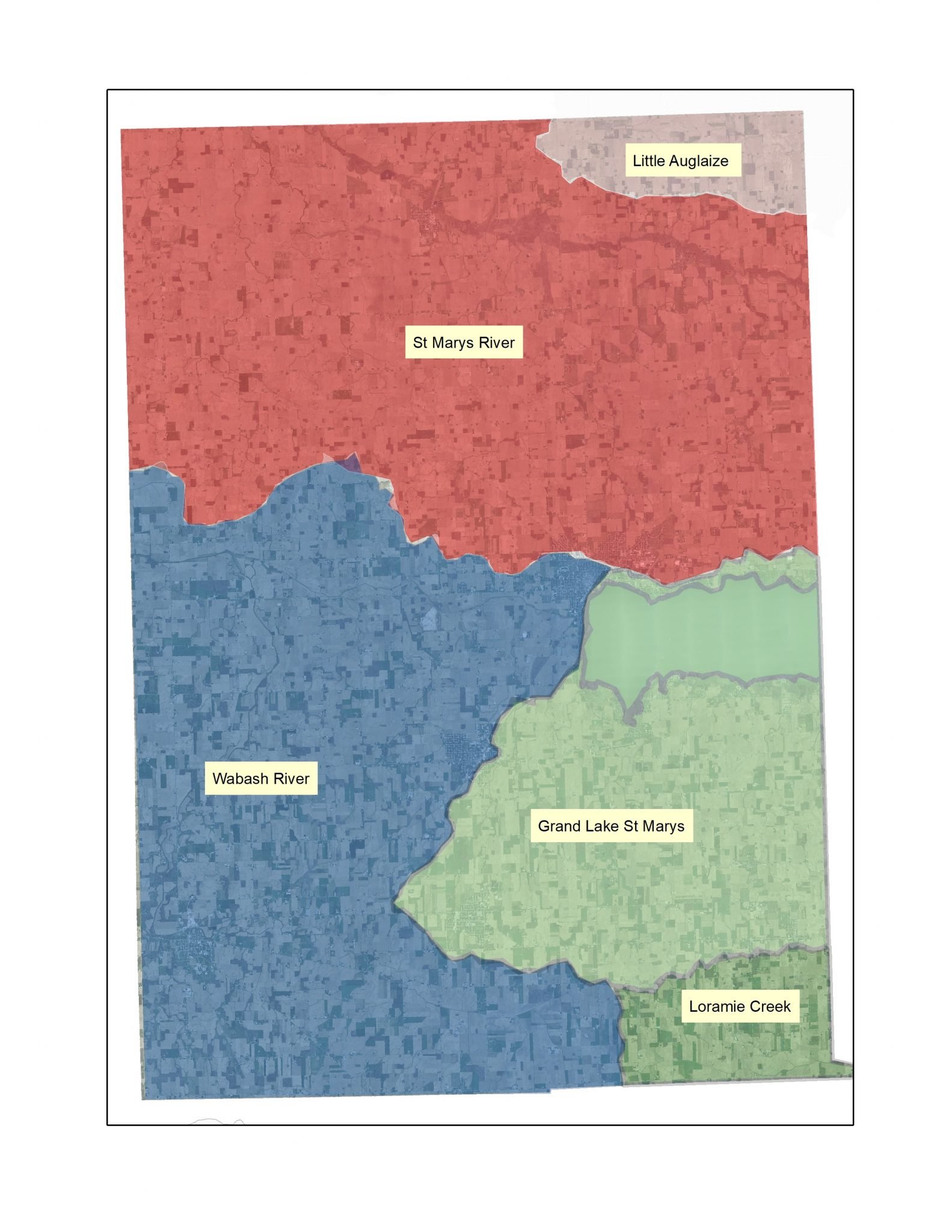
A watershed is an area of land that drains to a particular body of water. As rainwater and melting snow run downhill, they gather sediment and other materials and may carry them into our streams, lakes, rivers, wetlands and groundwater.
We all live in a watershed. Homes, farms, forests, small towns, big cities and more make up watersheds. Watersheds cross county, state, and even international borders. In some areas watersheds are also called drainage basins. Watersheds come in all shapes and sizes. Some encompass millions of square miles; others are just a few acres. Watersheds are nearly always part of a larger watershed.
Everyone relies on water and other natural resources to exist. What you and others do on the land within your watershed impacts the quality and quantity of water and our other natural resources. Everything that is done in a watershed affects the entire watershed’s system.